Japan by TRAIN
Tokyo, Nagoya, Kyoto, Osaka, Kobe, Takayama, Kanazawa
Click for Japan Slide Show
This is an itinerary of a Japan trip by train with photos, maps and text describing these places. It was a three-week trip starting and ending in Tokyo, including Nagoya, Kyoto, Osaka with the EXPO 2025, Kobe, then to the smaller cities of Takayama and Kanazawa. Travel by train in Japan is quite easy, whether by high-speed Shinkansen between cities, or standard JR trains, and efficient subway systems in the major cities. This is an itinerary that anyone can do on their own, without need for a group tour.
The maps were made using Google My Maps, a free service that enables you to build your own maps and load them up with visitor attractions, historic sites, restaurants, hotels, and anything else of interest. You do most of this research before the trip to create the maps, then you can update them and add more information while travelling.
Each of these maps can be enlarged to full screen by clicking the rectangle in top-right of the frame.
Down below you will find detailed explanations for creating Google My Maps.
Japan Travel Route
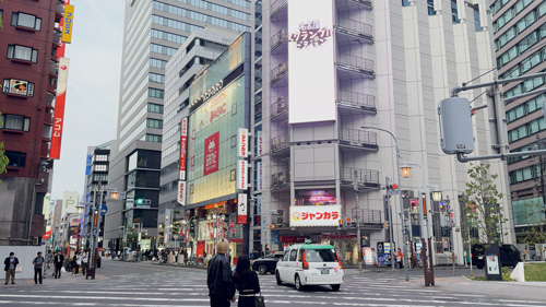
TOKYO
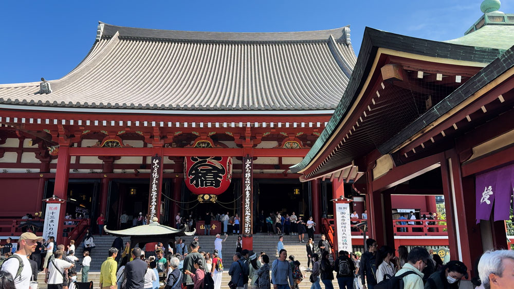
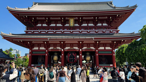
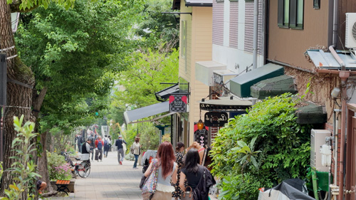
The world’s biggest city dazzles with its blend of tradition and innovation. From the serene temples of Asakusa to the vibrant chaos of Shibuya and Shinjuku, the city offers something for every traveler. Visitors can explore high-tech marvels, indulge in world-class cuisine, and shop in eclectic districts like Harajuku and Ginza. Art lovers enjoy museums and digital installations like teamLab Planets. Efficient transit, endless dining, and unique neighborhoods make it an unforgettable introduction to Japan’s energy and diversity. This sprawling megacity features iconic districts like Shibuya with its famous crossing, tech-focused Akihabara, and traditional Asakusa with Senso-ji Temple. Tokyo offers everything from cutting-edge technology and skyscrapers to serene gardens and ancient temples, creating an unforgettable urban experience that perfectly captures modern Japan's essence.


TOKYO places
or view the map on Google My Maps
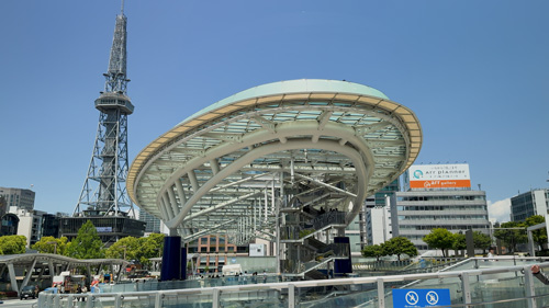
NAGOYA
Often overlooked by tourists, and less crowded than Tokyo or Kyoto, Nagoya offers a relaxed pace. Japan's fourth-largest city blends samurai heritage with industrial innovation. Home to the impressive Nagoya Castle and sacred Atsuta Shrine, while modern attractions include Oasis 21 complex and Toyota museums. Visitors can sample local dishes like hitsumabushi (grilled eel) and miso katsu. Nagoya is a surprising, rewarding stop on the Tokaido Shinkansen line. The city offers unique cuisine including hitsumabushi (grilled eel), miso katsu, and tebasaki chicken wings. Nagoya serves as an excellent base for exploring central Japan with its bullet train connections.
NAGOYA Places
or view the map on Google My Maps
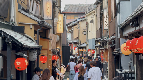
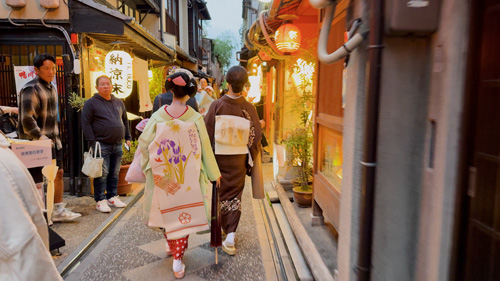
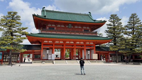
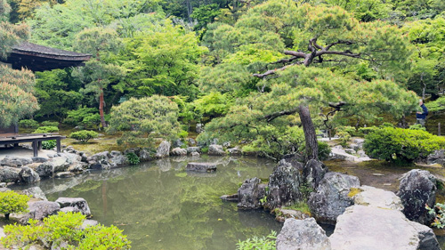
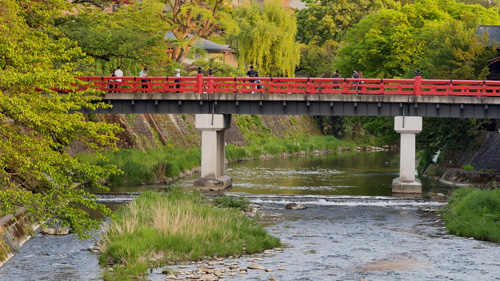
KYOTO
Japan's former imperial capital for over a millennium, Kyoto preserves the nation's cultural and spiritual heart with over 2,000 temples and shrines. Iconic sites include the golden Kinkaku-ji (Golden Pavilion), Fushimi Inari's vermillion torii gates, and Kiyomizu-dera Temple with panoramic city views. The historic Gion district offers glimpses of geishas, while Arashiyama's bamboo groves create magical walking experiences. Traditional wooden machiya houses line narrow streets housing tea ceremony schools and kaiseki restaurants. The Philosopher's Path provides contemplative walks among cherry trees. Kyoto offers tea ceremonies, seasonal festivals, and historic charm at every turn. Despite its popularity, Kyoto retains a tranquil, spiritual atmosphere perfect for cultural immersion.
KYOTO Places
or view the map on Google My Maps
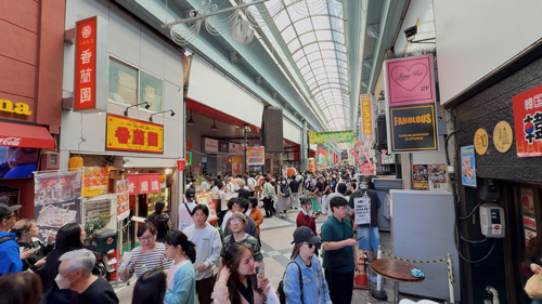
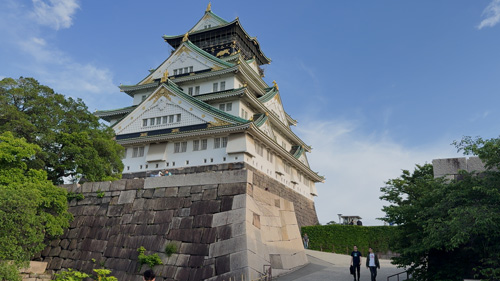
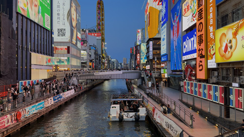
OSAKA
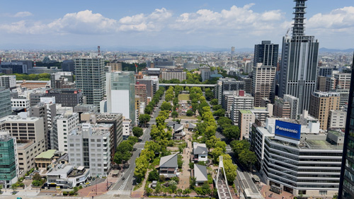
A city full of character, Osaka is Japan’s culinary capital, famous for street food like takoyaki and okonomiyaki. Its Dotonbori area bursts with lights, flavors, energy and boat rides along the restaurant-lined canal, which adds to the area's lively atmosphere and provides scenic views, especially at night. The city has a relaxed, humorous spirit, seen in its people and comedy culture. Must-visits include Osaka Castle, Universal Studios Japan, and the lively Kuromon Market. A transportation hub in Kansai, it’s also perfect for trips to Kyoto, Kobe or Nara. Osaka’s mix of great food, fun attractions, and friendly vibes make it a favorite for a casual, enjoyable Japan experience. The vibrant Dotonbori district epitomizes Osaka with neon lights, mechanical signs, and bustling nightlife along the canal.


OSAKA Places
You can also view the map on Google My Maps
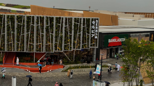
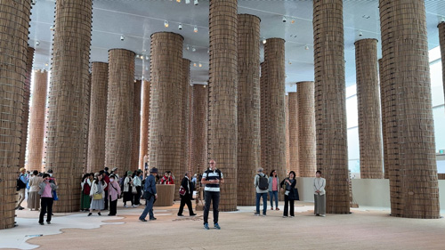
OSAKA EXPO2025
One of the most exciting things happening in Japan in 2025 is the Osaka EXPO, a world exposition held in Osaka, Japan, from April 13 to October 13, 2025. The exciting event features the theme "Designing Future Society for Our Lives," focusing on health, sustainability, and innovation. Over 150 countries and organizations are participating, showcasing cutting-edge technologies and cultural exhibits. A central feature is the Grand Ring, a two-kilometer wooden structure symbolizing unity. The expo aims to attract 28 million visitors, offering a platform for global collaboration and envisioning solutions to contemporary challenges.


OSAKA EXPO2025 Places
You can also view the map on Google My Maps.
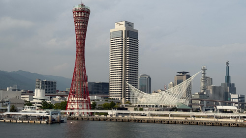
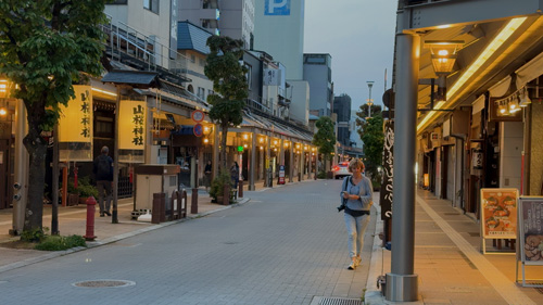
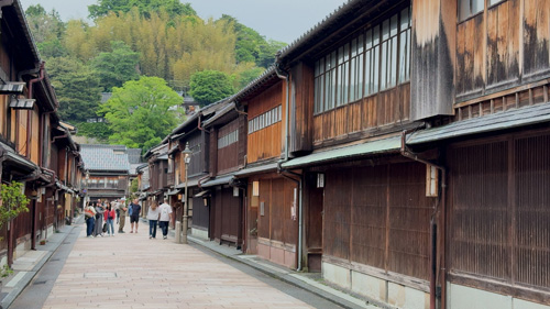
KOBE
Kobe is a cosmopolitan port city known for its scenic beauty, international flair, and world-famous Kobe beef. Nestled between mountains and sea, it offers stunning harbor views and easy access to Mount Rokko for panoramic vistas and onsen retreats. The city’s Kitano district features European-style architecture from its foreign settlement past, while the bustling Nankinmachi (Chinatown) adds a lively cultural mix. Kobe is also known for its fashion-forward vibe, sake breweries in Nada, and peaceful waterfront areas like Meriken Park. Elegant yet relaxed, Kobe makes a stylish and diverse stop on any Kansai itinerary.


KOBE Places
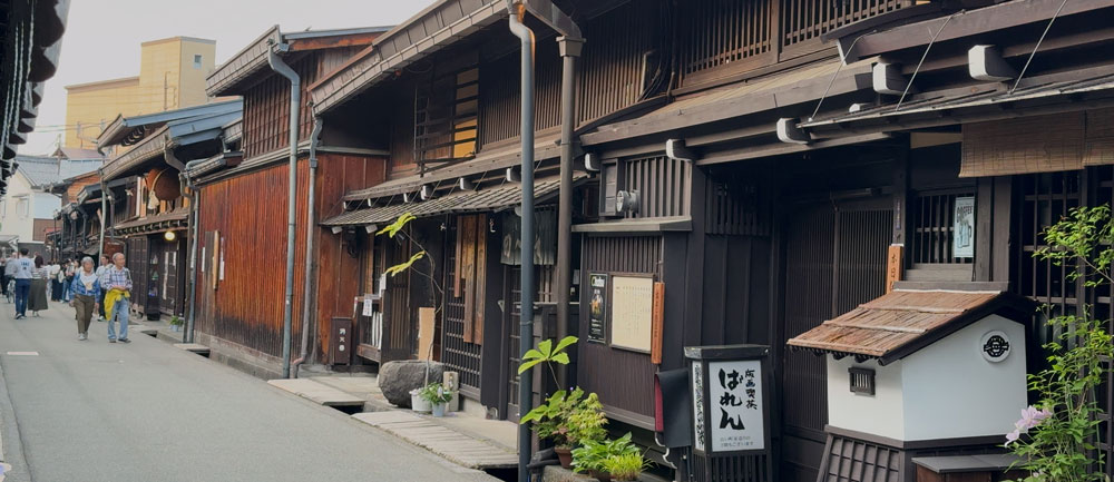
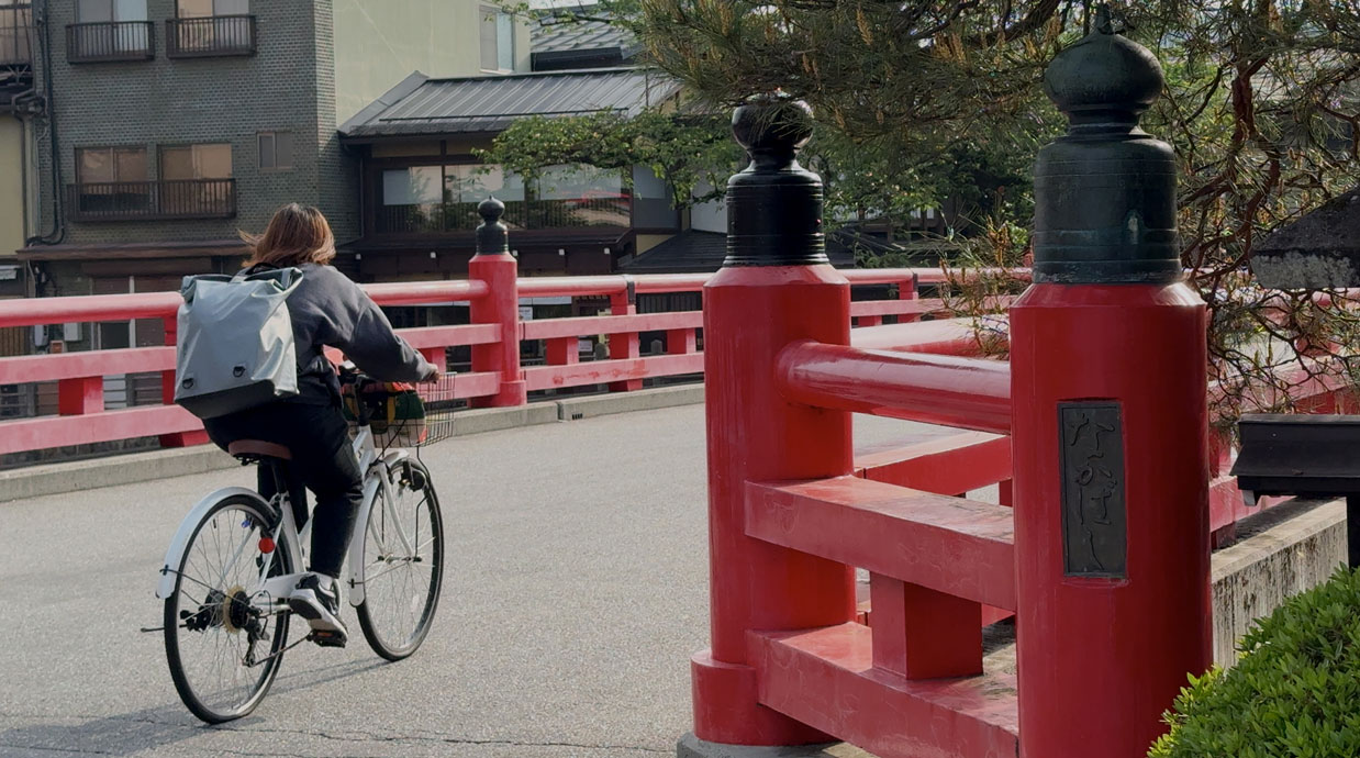
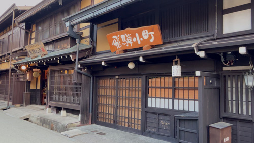
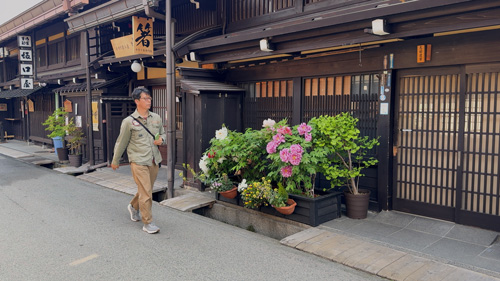
TAKAYAMA
This is one of the best-preserved old towns in Japan, with wooden buildings dating back to the 17th century. Step back in time in the scenic Japanese Alps to Takayama. Its well-preserved Edo-period streets are lined with historic wooden buildings, sake breweries, and markets along unchanged centuries-old streets. Visitors can explore the Hida Folk Village or take a trip to nearby Shirakawa-go. With local crafts, mountain cuisine, and peaceful ryokan inns, Takayama is ideal for travelers seeking authentic charm and natural beauty away from Japan’s fast-paced cities. Daily morning markets along Miyagawa River offer local crafts and delicious foods. Traditional festivals, mountain hiking, hot springs, and sake brewing in the cold climate make Takayama one of Japan's most authentic cultural experiences.
TAKAYAMA Places
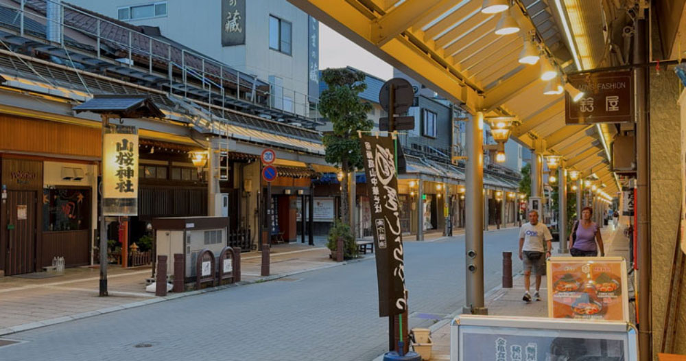
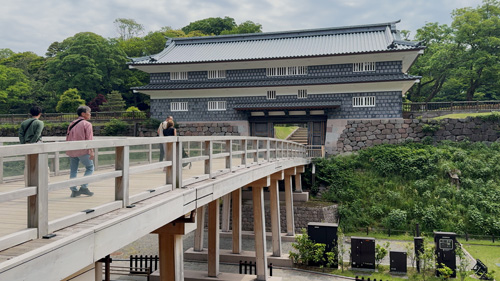
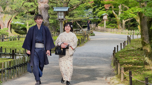
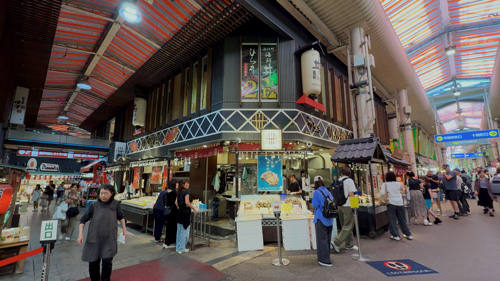
KANAZAWA
Kenroku-en Garden is Kanazawa’s top attraction, one of Japan's three most beautiful gardens, featuring famous snow-protecting yukitsuri ropes and seasonal beauty. The 300-year-old Omicho Market offers incredible Sea of Japan seafood, many other foods, handicrafts and clothing. The city’s samurai and geisha districts—Nagamachi and Higashi Chaya—are perfect for scenic walks. Less touristy than Kyoto but equally rich in culture, Kanazawa offers a refined, relaxing taste of traditional Japan with an artistic edge. Kanazawa, capital of Ishikawa Prefecture, represents one of Japan's most culturally refined cities where traditional arts flourish alongside the modern city. Kanazawa charms with historic elegance and coastal flair.
KANAZAWA Places
or view the map on Google My Maps
Google My Maps
One of the best ways to prepare for a trip is put your information together in one place in Google My Maps (GMM), then use it on your mobile device while walking around. All of the above maps were created using Google My Maps (GMM), with detailed instructions following to show how to make these maps.
When you arrive in a strange new city the map you have created will show you where to go and describe the sites, with links all in one place on your mobile device. In that way you will not get lost upon arriving in a town for the first time, because with the map on your mobile you will know what to see, where to go, and how to get there -- just follow that dot on the map.
To make a new map you need to have or create a google account. Follow steps below to create a new map, name and save it, then add your own points of interest.
To create a new map sign in to Google My Maps with this link:
Why Make a Map?
Create your own custom map that will help you navigate to your points of interest in real time using your mobile phone or iPad, as explained below. You can use it while walking around to easily find important attractions.
This is based on Google Maps, but is far superior because you can add a lot of customized information which is easy to access. These descriptions act like a digital guidebook as you walk around, so you know where to go and understand what you are looking at.
Make a list of places:
Do your research at home in weeks and months prior on your computer using travel websites, guidebooks, YouTube and many other sources to figure out what you want to see. Various AI sources are especially useful in compiling lists of what to see, as explained in great detail down below. Then load your places on the map.
How to Make Map
Illustration of various GMM control options
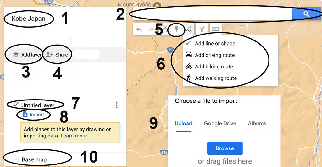
1 map title; 2 search bar; 3 add new layer; 4 share with others; 5 place pin manually in map; 6 add line or shape; 7 add layer name; 8 click to import csv list; 9 drag csv from computer to this window; 10 base map to choose appearance of the map
Adding places to map, one at a time:
You could place items on the map one at a time by typing the place name into the search bar on top of the map at the magnifying icon, then find the pin that appears and click "save to map". If a site is well-known it will often be listed as part of the map, so all you need to do is click that name and a pin will open which you can add to map, usually including links and descriptions.
However, it can be time-consuming to individually import each single place, e.g., restaurant, historic site, plazas, shopping street, museum, or any specific thing you are wanting to see. Instead, many sites can be added more quickly and efficiently as a group, in a batch, as explained next.
Batch is Best
This is a powerful technique that enables you to bring in a complete list of places all at once, adding them with a single click. This might sound a bit complicated but is much faster than adding places individually, and can be summarized as follows:
- Assemble your list of places to visit as a plain text list.
- Save the list as csv file using Excel or other spreadsheet.
- Import the list to GMM where it will show up as points on the map.
It is best to make separate lists by categories, such as historic sites, hotels, shopping streets, restaurants, then you can build individual map layers with those themes. The map pins for a topic can then be color-coded to provide visual distinction. You could first alphabetize the list or arrange it by region. Add new layers for each of these topic themes.
Make list then convert to spreadsheet
First, create a plain text list of all your desired sites to see, with a short paragraph for each site that includes place name and description. You can also add links about each item in the same paragraph. You can quickly build this list of sites with help from AI, as explained below.
You must place a separator like a semicolon after the place name so that the spreadsheet will have two columns, one for the place name, the other for the description. Keep each place with description in its own paragraph.
Open the text list in Excel or similar then save as csv (comma separated value). For best results fill an empty column on the right side with the name of the city, and add a row on top with headings such as place, about, city. This will help GMM correctly put your sites in the right location on the map, with descriptions included.
Import list to map:
On your blank GMM make a new layer then click import. You then drag the csv file you just created from your computer directly to that import window. When you import that csv to GMM, each place will automatically get its own pin locator, which will also display any description you may have provided.
Continue adding layers for your various topic lists, such as restaurants, hotels, visitor attractions, etc. As mentioned, it is useful to keep these items in separate lists with their own csv file, so you can provide distinct color and icon style to each group. This is best done by choosing "uniform style" for that layer and choosing from the color picker and symbol list for that group. However when you apply uniform style to a layer, you cannot then have a variety of different colors and icons on that layer. If you want that variety, make the layer style choice as "individual styles," perhaps in a separate layer called 'misc.'
Possible Errors:
The import is not always perfect. Sometimes you get an error that a few rows “couldn’t be shown" perhaps because they were poorly labelled or describe a common site name found elsewhere in the world. To fix it, click “Open data” then often all you need to do is click on the place with the error, and its description, which might resolve the error. If that doesn't work add the city name again as part of the place name. Zoom out on your map to find those misplaced items and re-label specific to your location by adding the city name to the place name. If that stray marker still will not move, delete it and manually re-enter the place.
Manually Add Places
You can also add new places one at a time, although not an efficient way to build the initial map (see above). Manual entry is especially useful while you are traveling and want to add new discoveries you find through ongoing research or tips from talking to other people.
- In the search bar, type the name or address of a place.
- Click one of the results on the map.
- If the result is what you want, click Add to map.
- If not, try another of the suggested results.
Alternatively, you can simply click on a place on the map which will create a pin you can then label. If you click on a a landmark or known place, Google will create a pin with the name and information, which you add by clicking “add to my map.”
You can make these additions right on your mobile device, or on a computer, especially easy when travelling with a laptop. The map is hosted in the cloud, so any changes you make to the map will immediately show up on all devices.
Mobile Devices:
All the information you gathered for the map are now in one compact device. Phones are more portable, but maps benefit from the larger screen of an iPad. If using the iPad with that helpful larger screen it is useful to wear a shoulder bag carrying the iPad on your side in an open pocket easy to reach so you can quickly grab it for reference.
Wander -- with help
Then go wander freestyle, beyond the pins. The digital map enables you to cut loose and explore those side streets away from the crowd and discover little shops, restaurants, plazas. Put the map away and wander, get a little lost, then pull it out to figure out where you are and how to get back on track. Wandering is certainly fun and important, but can be a waste of time and energy if you get lost or just go into boring places. With the digital map you can quickly get back on track to fun places.
This strategy gives you total freedom along with extensive information to make your trip a total success. Now the only problem is having enough energy to walk to all these places on your digital list.
Sharing:
To allow others to view the map, share it by clicking "share" at the top of the map column on the left.
To embed map on your website, click in the three buttons in top of list panel on left side of frame. Select embed on my site. Copy code. Paste into website.
Import map information from other GMM:
Map data from one map can be imported into another map: Find good maps from others who are sharing, that has useful info; Click 3 dots in their map and choose 'Export as KML' and download kml file to your computer. Then insert the file in a new map, or add it to your existing map by creating a fresh layer and click import. Drag the kml file from your computer to that layer. Anyone making a map can agree to share it by clicking in the share button and turning on sharing. This gives you permission to use their data. If you share your map, others can benefit from the places you chose.
Add lines for walking or driving routes
- First, create pins for the various stops you want along your route.
- Click the "add directions" icon underneath the search bar.
- A new layer will be created, with “driving” route by default, which can be changed by clicking it to walking route, depending on your needs.
- This open up two empty panels, A and B.
- Select Panel A and click on the map the pin of your starting point.
- Click the next map point, which will then appear in the B panel.
- The route line will automatically generate between the two points.
- Click "Add Destination".
- Click on your next route point.
- Continue in the same way adding more points to your route line.
- You can add multiple stops (A → B → C → D, etc.).
- Add title by clicking on "untitled layer" and saving.
- Fine-tune your route by selecting and deleting any of the route points.
- Click on the three dots of that layer and you can select “step-by-step directions.”
- Those directions also include the number of minutes it would take to walk that route.
- You can move the line by clicking and dragging any point on the route (although that can get messy).
- You can delete entire layer if it is not working out well, and start over.
Add other lines
You can draw lines on the map, for example to outline an important sight, or neighborhood.
- Select a layer containing places (not a direction layer)
- Click the "draw a line" icon underneath the search bar
- Choose "Add line or shape" (to draw custom paths or boundaries)
- Draw Your Line
- Click to add the starting point on the map.
- Click to add each point along the path.
- Double-click to finish the line (or shape if it’s closed).
- A box will pop up—give your line a name and description.
- A layer can have 2,000 lines, shapes or places, while a map can have up to 10,000 lines, shapes, or places.
Map styles
Google offers a choice of 9 different map appearance with varying degrees of detail provided. It is best to choose the plain brown map, which minimizes the clutter of many other default pins you don’t need, so you can focus on your pins. Select that map at the bottom of the left column “Base map” choice, pick the brown map on line 2, right side.
Advantages of GMM over Google Maps:
While it is sometimes useful to switch your mobile device over to viewing Google Maps, for example to view street details and more complete shop listings, it is generally much better to use GMM as your daily navigation app.
Customization: GMM allows you to create personalized maps with custom pins, icons, and colors, making it easier to categorize locations at a glance. Google Maps only allows one emoji per map.
Multiple layers: GMM lets you add up to 10 layers per map, which can be toggled on and off to limit the view and avoid an overwhelming number of locations .
Route visualization: GMM allows you to add routes to visualize your trip for road trips or walking tours
Importing locations: With GMM, you can import location pins and routes from spreadsheets or past Google Maps timeline trips.
Adds notes: With GMM you can add personal notes to your map.
Shareability: You can create custom maps that you can share with others.
Google Maps limitation: Only allows starred/saved locations with limited categorization and customization.
GMM is better suited for pre-trip planning and itinerary organization.
Add richer annotation with detailed descriptions, links, and images to each point.
More useful for noting reservation info, historical context, or special travel tips at each stop.
Use AI to get useful information:
When constructing your list of sites for the maps AI can quickly provide extremely valuable suggestions, along with those guidebooks and websites mentioned earlier. AI is the best single technique for efficiently gathering and organizing travel information. Use it for research before your trip to prepare the maps, then use it often during the trip as new points of interest are revealed.
The answers provided by AI must be in correct format so you can bring them easily into Google My Maps. When asking the question (prompt) tell your AI sources to create the answer as a list using plain text and add semicolon after each place name, no bullets, no photos, single paragraph per place. This makes it easy to convert the text list in a csv spreadsheet using Excel or similar app, then import into your map.
Following are some basic questions you can use, then create more to suit your interests.
Prompts
Don’t confuse AI by asking too many questions in the same prompt. It is best to focus on a few topics at a time, asking the same brief question to several AI sources, then combine the various answers and eliminate dupes from that expanded list. Informative AI sources include ChatGPT, Gemini, Claude, Co-pilot and Perplexity.
Examples of prompts (questions for AI)
- What are the top attractions in [City]?
- List the main sights, shopping streets, pedestrian lanes, small alleys
- List plazas and people-watching places
- Can you tell me about the history of
- What is the best time of year to visit
- Accommodation:
- What are some highly-rated hotels
- Are there any unique or boutique hotels
- Can you recommend budget-friendly accommodations
- Dining:
- What are the best restaurants
- Where can I find local cuisine
- Are there any famous food markets or street food spots
- Activities and Entertainment:
- What are some must-do activities
- Are there any popular festivals or events
- Can you recommend any live music venues or theaters
- Transportation:
- What is the best way to get around
- Are there any public transportation passes available for tourists
- How do I get from the airport to the city center
- Local Tips:
- What are some hidden gems or off-the-beaten-path spots
- Are there any local customs or etiquette I should be aware of
- Can you suggest any day trips or excursions from
Suggestions from other sites:
You can find many websites and YouTube videos with further instructions onf building your Google My Maps, by doing your basic search. However the strategy presented above is your best single guide, with more advanced techniques than you can find elsewhere!
Tips from Google: with this link
UCSC Library Guide to Google My Maps: A concise guide that covers the essentials of creating maps, managing layers, and customizing icons and colors.
YouTube instructional videos:
Create a Custom Map with Google My Maps
How to Plan Your Trip With Google MY MAPS
Revolutionize Your Travel Planning with AI & Google My Maps!
You can certainly find more help by searching the web, but the guide provided above is all you need to build informative maps that will help guide you in your travels.